Fatal flash floods strike northern Iraq amid severe regional weather
Torrential rains in Erbil killed two people as Storm Bruna approaches Portugal and cold snow blankets Japan.
By Marina Weber ·
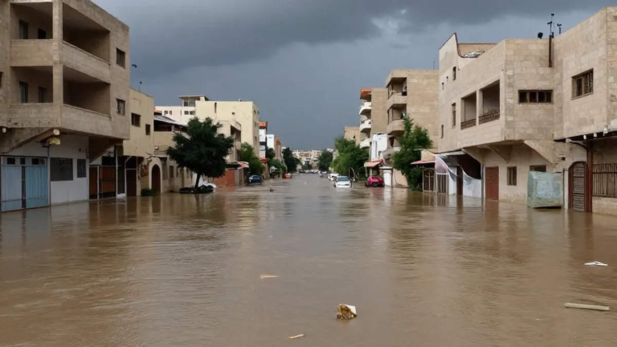
Severe thunderstorms swept across the Middle East on Saturday, triggering deadly flash floods in northern Iraq. The city of Erbil suffered the most extensive damage, with streets inundated by torrential rain that fell over a remarkably short period. Homes and businesses in the area sustained significant structural harm as water levels rose rapidly.
Meteorological data indicates that the rainfall in Erbil far exceeded initial forecasts. Authorities estimated that approximately 80mm of rain fell on the city, which is considerably higher than the predicted 30mm. The intensity of the downpour overwhelmed local drainage systems, leading to widespread flooding. Tragically, two people lost their lives in the floods, highlighting the sudden and dangerous nature of the weather event.
The severe weather system did not stop at Iraq's borders, affecting neighboring regions including parts of Iran. The storms marked a dramatic shift in regional weather patterns, catching many residents off guard. Emergency services worked throughout the day to clear debris and assist those stranded by the rising waters in the affected districts.
Across the Atlantic, Europe is preparing for the arrival of Storm Bruna. The system is forecast to bring strong winds to Portugal during the current week, with the west coast expected to bear the brunt of the impact. Gusts are anticipated to reach speeds of 50mph, or 80km/h, accompanied by heavy rain and thunderstorms.
The storm has already begun to make its presence felt in the Canary Islands. On Saturday night, Tenerife recorded a wind gust of 80mph, signaling the intensity of the system approaching the mainland. By the end of the week, total rainfall in affected areas of Portugal could accumulate to 200mm, potentially causing further disruptions to transportation and daily life.
In East Asia, Japan experienced a cold and snowy conclusion to the previous week. Additional snowfall is expected in Hokkaido and the mountainous regions of the main island, Honshu. Temperatures are forecast to drop below the seasonal average early this week, marking a significant cooling trend for the region.
Sapporo, the capital of Hokkaido prefecture, is expected to see temperatures plunge to 10C below the seasonal norm. Maximum temperatures in the city are likely to hover between 4C and 6C on Monday and Wednesday. However, Tuesday is forecast to be the coldest day, with a high of approximately 0C. Minimum temperatures could fall to -6C by Wednesday, with other western parts of Hokkaido potentially reaching -8C on Tuesday.
The recent snowfall, which began on Friday, has led ski resorts to prepare for an influx of visitors. Significant accumulation is expected, with areas around Kiroro and Niesko likely to receive between 30cm and 50cm of snow. Furano, Rusutsu, and Sapporo are projected to see between 20cm and 30cm. Other resorts may also accumulate up to 20cm by Wednesday.
Strong winds accompanied the snowfall over the weekend, with gusts of about 75mph reported in Kiroko and Niesko. These conditions, while ideal for some winter sports, have added to the challenging weather experienced across the country. The combination of cold temperatures and high winds has made travel difficult in several mountainous areas.
Global weather patterns are also being influenced by a strong El Niño event. At its peak in late October, sea surface temperatures in the equatorial Pacific were recorded at about 3.5C above the climatological average. This anomaly has resulted in air temperatures in Peru that are 5C to 10C above the seasonal norm. These unusually warm conditions are expected to persist into the coming week, affecting local agriculture and daily activities.